Hamburg Airport (HAM)
City Orientation and Maps
(Hamburg, Germany)
Sited on the northern side of Germany, Hamburg is one of the country's largest cities, with a population of around 1.7 million. Prominent cities within driving distance of Hamburg include Hannover, which is situated around 160 km / 100 miles to the south and can be reached in less than two hours. Also nearby is the capital city of Berlin, which is around 290 km / 180 miles to the south-east of Hamburg, with a journey time by car of less than four hours.
To the north of the city and past Hamburg International Airport (HAM) you will find a number of notable towns, such as Norderstedt, Elmshorn, Neumünster, Rendsburg and Kiel - next to the coast. Bremen is also nearby and just a short trip to the south-west.
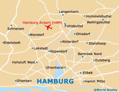
Hamburg International Airport (HAM) Maps: Important City Districts
Within the city itself you will find plenty to do. Much of Hamburg has been shaped by its three large rivers - the River Alster, the River Bille, and the Elbe River, together with a series of canals. Many of the top attractions in Hamburg line the rivers and surprisingly the city contains more bridges than even Venice, numbering over 2,500. Cruises provide a good way to begin your sightseeing and gain your bearings.
Hamburg's main sights lie in the semi-circular shaped city centre, located on the northern side of the River Elbe. The Alsterfleet is a prominent canal that bisects this area diagonally, dividing the Neustadt and Altstadt districts.
The main Hauptbahnhof train station can be found on Glockengiesserwall, to the north-east of Hamburg city centre, with a further three train stations located nearby. A spreading city full of character, prominent districts include St. Georg, St. Pauli, Schanzenviertel, and the University Quarter. Also worth noting, a number of wealthy residential neighbourhoods lie close to Hamburg's huge Outer Alter Lake.
Germany Map

Hamburg Map